admin1 admin

Ban Kut Ngong boundary marker

It is a large boundary marker over 2 m high, made of red sandstone, carved in patterns on allegory and images of Bodhisattva. Some of them have inscriptions of the Pallava script of South India. They are found in large numbers around the village, therefore kept within the temple pavilion around Wat Kut Ngong near Wat Kut Ngong school. The markers were used to determine the boundaries of the monks’ rituals. Activities not to be missed – Seeing over 30 pieces of ancient Dvaravati art of large boundary markers Address: tambon Bung Khla, amphoe Mueang, Chaiyaphum province 36000 Opening hours: Every day from 8 am – 5 pm Recommended travel season: All seasons How to get there: From Chaiyaphum city, take Highway No. 202 for about 12 km, turn right for another 3 km to Ban Kut Tum, then turn right to the route Kut Tum – Bung Khla, another 4 km. พิกัดการเดินทาง/GPS : https://goo.gl/maps/gfVBsELbagwR8drs6

Tad Ton National Park

“Covering some areas of the Phu Laen Kha mountain range, it has waterfalls that flow against the rock slabs, creating a beautiful picture, such as Tad Ton waterfall, Tad Fa waterfall, and Pha Iang waterfall within the park. Each waterfall is striking.” Must-see attractions Tad Ton waterfall-one of the most beautiful waterfalls in the Northeastern region. Tad Fa waterfall– a beautiful waterfall with natural slides Pha Iang waterfall– with peaceful atmosphere suitable for relaxation Activities not to be missed – Swimming on the stone terrace and basin at Tad Ton waterfall – Enjoying natural slides at Tad Fa waterfall – Relaxing under the shade of trees at Pha Iang waterfall. On December 25, 2015, Tad Ton officers discovered the Khmer alphabet in the park. In May 2017, HRH princess Maha Chakri Sirindhorn on opening the library at the NFE in Chaiyaphum province learned about this Khmer alphabet and was very interested. She asked the officers why it was just discovered. She took out her phone and took pictures. Address: tambon Na Fai, amphoe Mueang Chaiyaphum, Chaiyaphum 36000 Opening hours: Every day 8.30 am – 6 pm Recommended travel season: During the rainy season when the water abounds and the waterfall is very beautiful How to get there: From Chaiyaphum city, travel along Highway 2051 approx. 20 km to the park office Page : Tad Ton National Park พิกัดการเดินทาง/GPS : https://goo.gl/maps/haMw5bJ1CVK132ev7

Phu Laen Kha National Park

With an area of ​​148 km2, it covers an area of ​​4 districts, namely Mueang Chaiyaphum, Ban Khwao, Nong Bua Daeng and Kaset Somboon. The topography is mountainous complex. The forest condition includes both dense and sparse forests. It is the source of the creek that flows into the Chi River. It is suitable for visiting during May-December.  The park provides a nature trail through the attractions in the park. Must-see attractions include Mo Hin Khao – a famous place in Chaiyaphum province Hua Nak Cliff – see the sea of mist during the rainy season Prasat Rock – another important viewpoint within Phu Laen Kha national park Klong Gate – looking like a strange natural stone arch. Orchid Cliff – there are many orchid species on the cliff. It is a nature trail. Activities not to be missed – Many nature trails inside – Setting up a tent at Phu Laen Kha viewpoint. This is suitable for those who like to experience nature. – Taking photos with the famous landmark, Mor Hin Khao. Address: tambon Huai Ton, amphoe Mueang Chaiyaphum, Chaiyaphum province 36000 Opening hours: Every day from 8 am – 6 pm Recommended travel season: Can be travelled in any seasons, but winter is the most beautiful during the months of November – January. Travelling : From Chaiyaphum province, take provincial Highway No. 2051 (Chaiyaphum – Tad Ton) for about 6 km, there will be a junction on the left to provincial Highway No. 2159 (Chaiyaphum – Nong Bua Daeng) until Km 26, there is a junction on the left to the national park office. Page : Phu Laen Kha National Park Tel: 093-093-9192-3 พิกัดการเดินทาง/GPS : https://goo.gl/maps/gvVQT1oLJD2Du32L6

Thung Bua Daeng Bueng Lahan

There are many red lotuses in the middle of Lahan Lake where tourists can take beautiful pictures of the lotus that bloom in the morning light. See the lifestyle of villagers who are engaged in fishing in Lahan Lake. There is a bamboo bridge extending into the swamp to capture beautiful pictures of the red lotus fields. Activities not to be missed – Taking a local rowing boat to see the red lotus – Cycling around the lake to see the beauty of the red lotus fields Address: Bueng Lahan, Ban Makleua, tambon Ban Kok, amphoe Chatturat, Chaiyaphum province Opening hours: daily from 6 am – 6 pm Recommended travel season: February – May (The best time to see the lotus is 6:30 am – 7 am) How to get there: From amphoe Chutturat, head to Highway No. 2170, turn right to wat Makleua for another 4 km to reach Thung Bua Daeng, Tel: 044-812-350. Page : Bueng Lahan พิกัดการเดินทาง/GPS : https://goo.gl/maps/wWLX2UEzmsN8mC7m8

Phra That Nong Sam Muen

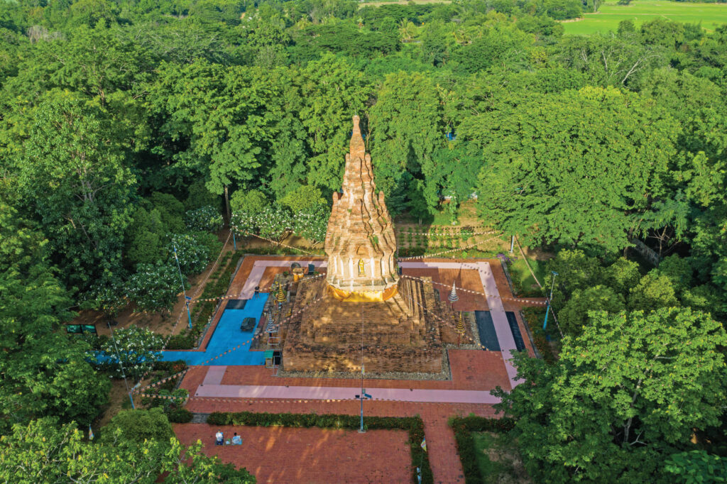
          It looks like a chedi with twelve indented corners. Located on a square base, it is one of the most important and interesting archaeological sites. The relics are beautiful and complete, from the architecture and art that blends between Lanna, Lan Xang and Ayutthaya. It is assumed that it was built during the reign of King Chai Chetthathirat of the Lan Xang Kingdom. The site of Phra That Nong Sam Muen was originally a large ancient city in the Dvaravati period, around the AD 7-11. Address : Tambon Ban Kaeng, Amphoe Phu Khiao, Chaiyaphum 36110 พิกัดการเดินทาง/GPS : https://goo.gl/maps/ktUYMwqQq6RKwe7S6

Wat Sila At

There are 9 Buddha images inscribed, which is the origin of the name “Phu Phra”. A large Buddha image is called “Phra Chao Ong Tue” by the locals. Nearby there are 7 Buddha images engraved around a sandstone pillar and a 7-inch black sandstone Buddha image with the same characteristics as Phra Ong Tue in front of another. The Fine Arts Department has registered it as an ancient monument and antiquities. Activities not to be missed – Paying homage to Phra Chao Ong Tue – Visiting the sacred pond behind the Buddha image Address: Village No. 6, Ban Na Kai Sao, Chaiyaphum-Phu Khiao Road , Tambon Na Siew, amphoe Mueang, Chaiyaphum Province 36000 Opening hours: Every day from 8 am – 5 pm Recommended travel season: All seasons How to get there: From Chaiyaphum city, follow Highway No. 201 (Chaiyaphum-Kang Kro) for about 15 km and turn left along Na Siew-Huai Chan Road for about 5 km and turn left to the temple for another 1 km. พิกัดการเดินทาง/GPS : https://goo.gl/maps/QCE1eZrfVUHaKDQDA

Prang Ku

It is a form of Khmer architecture in the Bayon style, during the reign of Jayavarman VII. It was one of the most important and perfect hospitals. The pediment and lintel are carved in sandstone, showing the intricacies of creating the image of the four-armed Bodhisattva Avalokitesvara standing in an arch above the pedestal of plants amid the rolling foliage. The people of the community have held a grand gilding ceremony of Phra That Prang Ku every year. Activities not to be missed – The community held the Phra That Prang Ku gilding ceremony around April. It has been practiced for a long time in order to maintain community’s good tradition. Address: tambon Nai Mueang, amphoe Mueang District, Chaiyaphum 36000 Opening hours: There is no exact opening and closing time. Travel season: all seasons How to get there: From the front of Chaiyaphum city hall to the east, follow Bannakarn Road for about 3 km to Prang Ku, which lies next to Wat Prang Ku. พิกัดการเดินทาง/GPS : https://goo.gl/maps/CUYZHzt99KRg6fEeA